
Honduras
Last updated: 28 January 2026
At a glance
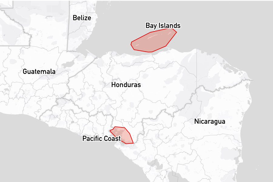
Honduras has coastlines on both the Caribbean Sea and the Pacific Ocean. Its main cruising area is the Bay Islands on the Caribbean side, a chain of islands along the offshore barrier reef, known for excellent diving and snorkelling.
The Pacific coast, by contrast, spans only a few miles along the Gulf of Fonseca and sees significantly less yachting traffic. Clearing here is handled by the Port Captain at Amapala on the main pier.
Attractions
Approaching from the west, Utila is the first of the Bay Islands, a laid‑back island with a strong backpacker presence and many dive centres along the main street. There is good diving and snorkelling, plus a solid choice of bars and restaurants. A popular excursion is to hire a golf cart to tour the island and perhaps visit the Utila Chocolate Co factory.
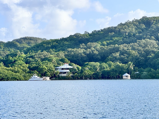
Roatan lies to the east of Utila and has two main harbours for visiting yachts: West End and French Harbour, with French Harbour being a popular place for cruisers to socialise. Along the south coast, numerous bights provide additional anchorages and give a better view of real life on the island.
Guanaja, furthest east, is the more remote of the three. Most residents live on Bonacca, a small island off the south coast whose narrow streets can be explored on foot, thanks to the mapping efforts of Denilson at the island's immigration office. The north coast offers notable snorkelling, including around St Michaels Rock.
Further south lies the Cayos Cochinos Marine Park, an archipelago of small sandy islands. Some are privately owned, while others host small fishing communities and can be visited by following the island chain by dinghy.
Places to stay
Below are the most popular and highly rated places to stay, based on reviews from the noforeignland community:
Anchorages

|
Michael's Rock
★
5.0
A very well-protected anchorage offers good holding in various wind conditions. Visitors enjoy excellent snorkeling and a striking waterfall nearby. The beach is also appreciated, though some reports mention occasional trash presence.
|

|
Mango Creek Lodge
★
4.9
Anchorage is sheltered and offers good holding in depths of 6 to 12 meters. Several reviews mention the absence of functional moorings. Visitors enjoy local lobster dinners and recreational activities including diving and hiking.
|

|
El Bight
★
4.8
Holding is strong with depths of 4-7 meters. Visitors report significant mosquito presence, requiring precautions. The nearby Mi Casa Too restaurant is noted for its views and decent food, adding to the anchorage experience.
|
|
Port Royal
★
4.7
Secluded anchorage with good holding and protection from swell, except to the south. Visitors experienced nice diving and snorkelling opportunities, as well as local boat traffic. Various activities available, including kiteboarding, with several visitors reporting positive experiences.
|

|
Significant positive feedback highlights the rich snorkeling and diving opportunities with diverse marine life. Visitors warn of potential hazards from boat traffic and mosquitoes. Limited anchorage options are noted, with emphasis on securing the anchor due to gusty winds.
|

|
Jonesville Bight
★
4.5
Protection is strong at this anchorage, with good holding mentioned in multiple Reviews. Visitors enjoyed access to various restaurants and explored the surrounding areas. Reports suggest anchoring can be challenging with debris, and depths require caution near the northern end.
|

|
Graham's Cay / Josh Cay
★
4.4
Anchoring is reliable with excellent holding recorded in sandy bottoms. The setting is attractive, with a well-rated restaurant providing meals and friendly staff. Protection from winds is noted, although conditions can become challenging with stronger gusts.
|

|
Old Port Royal
★
4.4
Anchoring conditions at Old Port Royal are generally favorable, with solid holding reported in mud and grass. Access to a peaceful beach and opportunities for exploration by dinghy enhance the experience. Expected swell may occur during southeast winds.
|

|
Utila Anchorage
★
4.2
Utila Anchorage features a protected environment with generally stable holding, although conditions can vary. Visitors reported clear water and a lively atmosphere, though ferry wakes can create some discomfort. Anchoring locations may require careful selection to avoid issues.
|

|
Rose Cay
★
3.3
Anchoring is possible with good holding in this area. Local boat traffic can be fast, and depth variations pose navigation challenges. Visitors may find friendly locals offering fresh seafood for purchase.
|
Marinas

|
Barefoot Cay Marina
★
5.0
A well-maintained marina featuring secure docks, professional staff, and an excellent restaurant. Visitors appreciate the peaceful setting and access to amenities such as a pool and efficient taxi service for nearby errands. Pricing is considered high but regarded as justified by the quality and services offered.
|

|
Roatan Yacht Club
★
3.6
Roatan Yacht Club features a new pool, a free dinghy dock, and various cruiser-friendly activities. Current issues include the presence of sargassum and a general sentiment regarding maintenance quality. Daily fees for dinghy dock usage have been implemented, encouraging responsible facility use.
|

|
Fantasy Island Marina
★
3.0
The marina is under construction with no power or water available. Earlier reviews highlighted enjoyable facilities such as a pool and community activities. Visitors should check recent Reviews for additional context or updates.
|
Moorings

|
French Cay Mooring
★
4.4
Many find the moorings difficult to pick up and recommend checking their condition due to maintenance concerns. Reports indicate the lack of fee collection as of late December 2023. Strong winds and close boat traffic may affect comfort while moored.
|

|
West End Mooring Field
★
4.3
The mooring field features good conditions for anchoring, though buoys can be difficult to spot. Visitors report effective shelter from various wind directions. Caution is advised due to boat traffic and security concerns, particularly with jet skis.
|
Boat services
Below are the most popular and highly rated boat services, based on reviews from the noforeignland community:
Chandlers

|
BIP Marine Supply Store
★
3.7
The small marine store sells basic items including anti-foul paint at competitive prices. It offers SeaHawk AF33 in numerous colors for $150 per gallon. However, stock may be limited to only essential supplies.
|
Boat services
|
Quiton James
★
5.0
Engine servicing is a key service provided. Reviews highlight effective repairs, such as replacing seals on raw water pumps and complete engine rebuilds. Visitors appreciate Quinton's communication and willingness to travel for future work.
|
Yacht clearance links
Useful yacht clearance links:
- Honduras Government: Pre-arrival notification
- https://www.jotform.com/app/cevamhn-dgmm/dgmm-hn
- Noonsite: Clearance procedures, processes and fees.
- https://www.noonsite.com/place/honduras/
Yacht clearance reviews
The following lists summarize noforeignland user reviews for clearing in at ports of entry and when using clearance agents in Honduras:
Ports of entry offices
|
Offers: Immigration.
Guanaja Immigration office is now operational for check-in, with reviews highlighting a welcoming officer and easy procedures. Many visitors appreciate the officer's local knowledge and assistance. Recent comments indicate a smooth check-in experience, though earlier reports of closure exist.
Place details mention: check in steps, required documents and fees or payments.
|
|
Offers: Immigration.
Maritime clearance is handled at a designated counter in a small mall. The procedure is described as quick and efficient, with no associated fees. Visitors have reported helpful and friendly staff interactions.
Place details mention: check in steps and fees or payments.
|
|
Guanaja Port Officer
★
4.0
Offers: Customs, and port authority.
Check-in procedures can be completed efficiently, usually within 15 minutes. Visitors should register online via QR code beforehand. Free registration and assistance is available, although internet access may be limited.
Place details mention: check in steps, required documents, fees or payments, prearrival requirements, cruising permits and departure requirements.
|
|
Utila Yacht Clearance
★
4.0
Offers: Customs, immigration, and port authority.
Processing for check-in is efficient, typically taking about 30 minutes. Staff interactions include friendly port captain assistance, although experiences with immigration personnel can be inconsistent, with some visitors facing difficulties. Bring copies of documents to expedite the process.
Place details mention: check in steps, required documents, fees or payments and prearrival requirements.
|
|
Offers: Cruising permits.
Service for extending cruising permits is available. Visitors should prepare copies of required documents, including visa extensions and boat details. Staff interaction may involve delays, as the port captain does not maintain consistent hours.
|
|
Offers: Customs, and port authority.
The process for extending a cruising permit at the port office is straightforward, typically taking only a few minutes. However, delays may occur as the port captain's arrival time can vary, particularly on busy cruise ship days. Visitors should check recent Reviews for additional context or updates.
Place details mention: opening hours, prearrival requirements, fees or payments, required documents and departure requirements.
|
Notes for mariners
Boats typically stay at anchorages along the southern coasts when moving between the islands. Some bays, including the main anchorage on Utila, can become exposed when wind directions turn. Reef passes are generally well charted but still require careful pilotage and good light.
The off-season
Few yachts remain in the Bay Islands during hurricane season. For those staying in Central America, the Rio Dulce in Guatemala is a well‑known hurricane‑season refuge with sheltered marinas, boatyards and yacht‑support facilities.
Facts for visitors
- Best times of year to sail here: December to April
- Most common type of shore power: 110v 60Hz
- Cost for provisioning (groceries): Medium
- Currency: Honduran Lempira (HNL)
- Personal security: Safety varies by region; urban areas can pose more risks
- Emergency phone numbers:
- Police: 911
- Fire: 911
- Ambulance: 911
- International dialing code: +504
- Time zone(s): UTC -6 (no daylight saving time)
Maritime history
The maritime history of Honduras traces back to the early Mesoamerican civilizations, with the Maya engaging in coastal navigation. They utilized the waterways for trade and cultural exchange, setting a maritime foundation long before European influence. Evidence of these early activities is highlighted in archaeological findings along the Atlantic coast and the Bay Islands.
Spanish colonialists established Honduras as an important port and trading center in the 16th century. The Bay Islands were particularly significant due to their strategic location, leading to piracy and conflicts between Spanish and British forces. Spanish fortifications, remnants of which can still be seen, were constructed to safeguard these valuable marine routes.
In more recent history, Honduras continues to play a pivotal role in Central American maritime trade. The port of Puerto Cortés serves as a primary gateway for imports and exports, linking Honduras to global trade networks. Modern maritime culture now also includes an expanding focus on tourism and recreational sailing, particularly in the Bay Islands, which attract divers and sailors from around the world.